
|
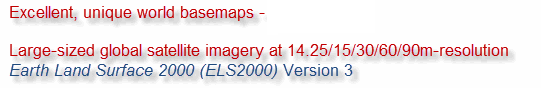
ELS2000 is based on
the invaluable Landsat imagery at
14.25m-resolution from
the USGS and NASA (~930 tiles or 8500+
scenes, file size ~4.5TB lossless
uncompressed), and with GeoSage's extensive experience in analysing the
satellite imagery of the entire Earth, the
processed result, in terms of both colours
and spatial resolutions, is very attractive and
impressive. Please compare our products with the same type of imagery on major mapping portals, and it is your call which source is more ideal and the most cost-effective for your applications. No gimmicks, seeing is believing! |
 |
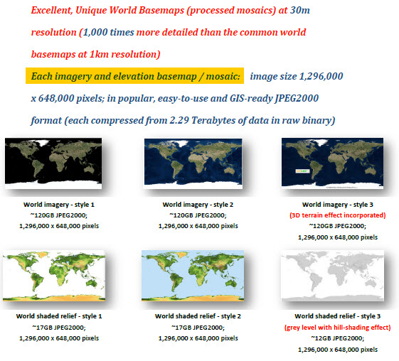
ELS2000 (including new updates in 2016):
- 30m-resolution global mosaics: An overview (style 2: ocean area: bathymetric shaded relief)
- 30m-resolution global mosaic style 3 (land area with 3D texture samples)
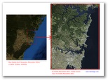
- Regional sample 1 - Tokyo Bay, Japan (14.25m-resolution); and its extended area (30m-resolution in JPEG2000)
- Regional Sample 2 - The entire U.S. West Coast including California (30m-resolution in JPEG2000)
 |
Ensure thorough, detailed
comparisons over the processed imagery from different
vendors before licensing. We are providing more than imagery itself; we feel it is equally important to provide some very special knowledge and practical skills on how to efficiently manage large-sized satellite imagery for the general users. Positive feedback has been received
from some of our international clients:
- "... We are really happy with this acquisition." -
Feedback from a major international defense contract
company.
- "... It takes us less than a day to make this
decision (to upgrade a license)." - A client in East
Asia soon after receiving and reviewing the data.
- "... The data looks fantastic!"; "It
is a ripper and the best imagery at this scale that
I have seen." (from a follow-up email) - A client in
the natural resources mapping industry.
Top quality (sharpness and vibrant colours) ||
Multiple styles || Handy, ready-to-use and easy-to-manage || The most
cost-effective and affordable || Large sizes ||
Many applications || Time-saving || Complimentary
terrain data for 3D rendering || Trusted by image
processing professionals
Clients who licensed our global or regional imagery products include:
 |
||
 |
 |
|
 |
 |
|
Anyone even with little or no geospatial experience is able to use our large-sized, GIS-ready global mosaics; it can be as easy as opening files! We show you how.
"Data+Software" model for system developers and integrators.
Generation of web
mapping tilesets (e.g. Google Map Tiles,
Bing Map Tiles and OpenStreetMap - OSM
Tiles). All
you need is a web server or
scalable cloud-based solutions (e.g.
Amazon Web Services) to host our colourful
and sharp world basemaps.
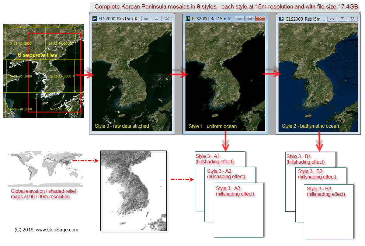
Customised 15m-resolution mosaics for large regions, e.g. Korean Peninsula
Korean Peninsula: A typical workflow for developing large-sized regional mosaics in multiple styles, including those imagery with 3D texture and hillshading effect. |
3D samples:
A - Standard GIS: Easily open the global satellite imagery mosaic and global elevation data in GIS for making endless, realistic 3D terrain simulations. This is to create and have your own "Google Earth" 3D terrain simulation yet without data streamed from Google servers!
Samples:
1 2 3 4 5 6 7 8 9 10 11 12
B - Fully-dynamic systems simulation and animation (for the aerospace & defence industry, digital games industry, etc.): Efficiently loading the open-and-go, 30m-resolution ELS2000 global mosaic (single file in JPEG2000 format) and the global elevation data in some enterprise-level 3D animation platforms, to make highly-immersive and fluid terrain and flights simulation.3D case study (loading global imagery time on a consumer-level PC: 2 seconds; Seamless zooming levels: from the entire globe to below 30m resolution at street level. Acknowledgements: http://www.AGENIUM.com/ and http://www.agi.com/)
ELS2000 can be provided at various spatial resolutions:
| Resolutions | Coverage |
Details | ||
| 90m |
|
Single file in JPEG2000, ECW
or other formats
|
||
| 60m |
|
Single file in JPEG2000, ECW
or other formats
|
||
| 30m |
Global coverage (including Antarctica with resampled Blue Marble Next Generation imagery): longitudes 180W-180E, latitudes 90S-90N ELS2000 (30m) V MODIS (500m) - 250 times more detailed |
Single file in JPEG2000, ECW
or other formats
|
||
| 15m (14.25m) |
Near global coverage except Antarctica; longitudes 180W-180E, latitudes 60S-85N Taking advantage of lossless uncompressed imagery source from USGS and NASA (False-colour inputs in JPEG2000 format can be provided as well). ELS2000 (15m) V MODIS (500m) - 1,000 times more detailed |
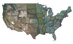
929 non-overlapping mosaic tiles, as shown in Figure 1
|
Delivery
Media:
ELS2000 datasets are usually stored on external hard
drives with USB 2.0 / 3.0 compliant interfaces.
Projection:
ELS2000 (14.25m) - Original UTM/WGS84
ELS2000 (15m, 30m, 60m
or 90m) - Latitude/Longitude Geographic WGS84
Format:
ELS2000 (14.25m or 15m) - JPEG2000 (preferred), ECW
- readily to be used by all GIS software
ELS2000 (30m, 60m or
90m) - JPEG2000, ECW or other formats
Pixel
resolution:
ELS2000
(15m) - 0.000138888 degrees (about 15m at
the Equator, Geographic WGS84) or 14.25m (for
UTM/WGS84)
ELS2000 (30m) -
0.000277777 degrees (about 30m at the Equator,
Geographic WGS84)
Number of mosaic tiles:
ELS2000 (14.25m or 15m)
- 929 (for a near global coverage except
Antarctica; longitudes
180W-180E, latitudes 60S-85N)
ELS2000 (30m, 60m or
90m) - single file
Total file size:
ELS2000 (14.25m or
15m) - JPEG2000, ECW format: ~800GB (for
UTM/WGS84) or ~1TB (Geographic WGS84)
ELS2000 (14.25m or
15m) - GeoTIFF format: ~4.3TB (for
UTM/WGS84) - extra costs involved.
ELS2000 (30m) -
JPEG2000, ECW format: ~200GB (for UTM/WGS84) or ~200
GB (Geographic WGS84)
ELS2000 (60m) - 10 to 50GB, depending upon compression ratios for
JPEG2000 or ECW format ELS2000 (90m) -
3.5 to 20GB
Earth Land Surface 2000 are based on NASA's orthorectified Landsat ETM+ GeoCover 2000, which consists of a total of ~930 mosaic tiles (or 8,500+ scenes) covering the entire earth land surface except Antarctica. Each original mosaic tile contains three false-colour, pan-sharpened bands at a spatial resolution of 14.25 m:
Band 7 (mid-infrared) displayed as red
Band 4 (near-infrared) displayed as green
Band 2 (visible green) displayed as blue
Original mosaic tiles in UTM/WGS84 were first carefully / manually selected, appended and evaluated, and later successfully converted into natural- or true-colour composites after applying spectral analysis techniques. True-colour outputs still retain the specifications of GeoCover 2000:
- All image scenes acquired during 1999-2003
- Projection and datum/spheroid: Universal Transverse Mercator and
World Geodetic System 1984 (WGS84). Between latitudes 60N-60S,
each mosaic is with the typical size of 6 (longitude) X 5 (latitude)
degrees; north of latitude 60N, each mosaic with the typical size of
12 X 5 degrees. To avoid the gaps between adjacent UTM zones
(a total of 60) when they are re-projected to others (e.g.,
geographical latitude / longitude), each mosaic extends for at least
50 km to the east and west, and 1 km to the north and south (Figure 1).- Cloud cover: 90% of imagery with 10% or less cloud cover
- Absolute positional accuracy: <50 m root-mean-square error
Robust spectral
transformation schemes have been
applied across all individual mosaics. The result is
a consistent, realistic and visually-appealing
representation of global land surfaces circa 2000.
This high-quality, medium-resolution dataset offers
a cost-effective solution to a wide range of
visualisation-related applications.
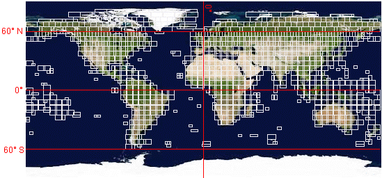 |
Figure 1: Locations of 929 mosaic tiles used in Earth Land Surface 2000
1. "Alive"
|
|
 UTM Zone 16N, Latitudes 80-85 UTM Zone 16N, Latitudes 80-85
|
 UTM Zone 40N, Latitudes 20-25 UTM Zone 40N, Latitudes 20-25 |
 UTM Zone 10N, Latitudes
75-80
UTM Zone 10N, Latitudes
75-80
2. Global / Continental / Country / Regional mosaics
We are also making high-quality, 15/30/60/90m-resolution, seamless imagery mosaics for any continent / country / region of interest, including:
Russia / Canada / China / United States / Brazil /
Australia / India / Argentina / Kazakhstan / Sudan /
Algeria / Democratic Republic of the Congo / Greenland
/ Saudi Arabia / Mexico / Indonesia / Libya / Iran /
Mongolia / Peru / Chad / Niger / Angola / Mali / South
Africa / Colombia / Ethiopia / Bolivia / Mauritania /
Egypt / Tanzania / Nigeria / Venezuela / Namibia /
Mozambique / Pakistan / Turkey / Chile / Zambia /
Myanmar / Afghanistan / Somalia / France / Central
African Republic / Ukraine / Madagascar / Botswana /
Kenya / Yemen / Thailand / Spain / Turkmenistan /
Cameroon / Papua New Guinea / Uzbekistan / Morocco /
Sweden / Iraq / Paraguay / Zimbabwe / Japan / Germany
/ Republic of the Congo / Finland / Vietnam / Malaysia
/ Norway / Poland / Oman / Italy / Philippines /
Burkina Faso / New Zealand / Gabon / Western Sahara /
Ecuador / Guinea / United Kingdom / Uganda / Ghana /
Romania / Laos / Guyana / Belarus / Kyrgyzstan /
Senegal / Syria / Cambodia / Uruguay / Suriname /
Tunisia / Nepal / Bangladesh / Tajikistan / Greece /
Nicaragua / North Korea / Malawi / Eritrea / Benin /
Honduras / Liberia / Bulgaria / Cuba / Guatemala /
Iceland / South Korea / Hungary / Portugal / Jordan /
Serbia / Azerbaijan / Austria / United Arab Emirates /
Czech Republic / Panama / Sierra Leone / Ireland /
Georgia / Sri Lanka / Lithuania / Latvia / Svalbard
and Jan Mayen / Togo / Croatia / Bosnia and
Herzegovina / Costa Rica / Slovakia / Dominican
Republic / Estonia / Denmark / Switzerland / Bhutan /
Netherlands / Taiwan / Guinea-Bissau / Moldova /
Belgium / Lesotho / Armenia / Solomon Islands /
Albania / Equatorial Guinea / Burundi / Haiti / Rwanda
/ Republic of Macedonia / Djibouti / Belize / Israel /
El Salvador / Slovenia / New Caledonia / Fiji / Kuwait
/ Swaziland / East Timor / The Bahamas / Montenegro /
Vanuatu / Falkland Islands / Qatar / The Gambia /
Jamaica / Lebanon / Cyprus / Puerto Rico / Palestinian
territories / Brunei / Trinidad and Tobago.
3. Access to data products locally
 |
Are you interested in large-sized, GIS-ready, global data products and having a copy locally? Please consider the following:
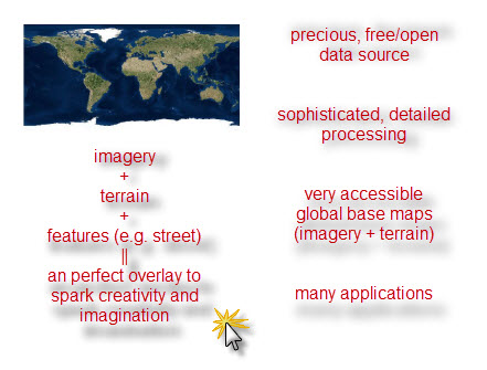
- Some business applications (e.g., real estate, 3D urban model) require very detailed imagery such as StreetView and oblique aerial photos, but for many applications such as landscape simulations and regional environmental studies, medium-resolution data from 14.25m to 90m-resolution would be sufficient.
- Imagine you have infrastructure and platform to make another virtual world, but are seeking a low-cost solution for quality, highly-processed global imagery and terrain data.
- Imagine the enormous expertise and resources that
are needed to reproduce the similar data products.
No time is to be wasted.
- Are you thinking of boosting company-wide mapping productivity using globally consistent data sets?
- Do your mapping applications require a global coverage?
- Will the imagery and terrain data be used by someone with little or no geospatial experience?
- Imagine you are interested in GIS desktop mapping and wish to make underlying imagery and elevation layers fully dynamic and integrative.
- Imagine you do not wish to have access to or are
feed up with periodic subscriptions to online
imagery tiles from virtual globes such as Google
Maps, Bing Maps and ArcGIS Online, due to concerns
over complex licensing terms, sluggish access speed,
unexpected network disconnections and lack of your
own control ...
4. Others - Free, efficient tools for viewing large-sized JPEG2000 files, e.g.
- QGIS (Most popular and open-source GIS)
- GeoViewer from LizardTech
Nowadays almost all popular GIS and remote sensing software can display JPEG2000 files easily.