1. Unique Large-sized Imagery Mosaics
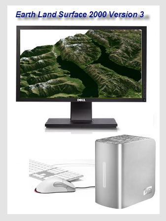
1.1 Global Satellite Imagery Mosaics / Basemaps at 14.25/15/30m Resolutions Enduring global imagery product Earth Land Surface 2000, including 30m-resolution unique world satellite imagery mosaics in multiple styles
1.2 U.S. State-level Imagery Mosaics at 1m Resolution Large-sized unique USA State-level Imagery Mosaics (e.g. Years 2015, 2014 & 2013) Please email us if you are interested in processing details and other info.
|
|
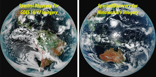
2. Tiled Web Maps of Near Real-time Imagery Spectral Discovery software developed to rapidly process near real-time JMA Himawari 8/9 and NOAA GOES 16/17 imagery, and tiled web maps available (e.g. every 10 minutes) for web & mobile apps
|
|
3. Licensing Software
Products
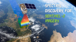
3.1 Spectral Discovery
for Sentinel-2 Imagery
Low-cost perpetual licence of Spectral Discovery for Sentinel-2 Imagery (Version 3.1) can be purchased via PayPal.
Full Version 3.1 - USD 89 |
|
|||
| - Handy band combinations | ||||
| - Adaptive image stretching | ||||
| - Advanced and fast image pan-sharpening | ||||
- Rapidly make 24 band combinations (including image stretching) in a batch mode. Now highlighting and selecting important image Features of Interest (FOI) becomes easy. 24 = 4x3x2, using 4 multispectral bands at 10m-resolution - Bands 02, 03, 04, 08 (~10 GB disk space required for each granule / tile) |
||||
- Rapidly make 120 band combinations (including image stretching) in a batch mode. Now highlighting and selecting important image Features of Interest (FOI) becomes easy. 120 = 6x5x4, using 6 multispectral bands at 20m-resolution - Bands 05, 06, 07, 8a, 11, 12 (~12 GB disk space required for each granule / tile) |
||||
- Rapidly make 6 band combinations (including image stretching) in a batch mode. 6 = 3x2x1, using 3 multispectral bands at 60m-resolution - Bands 01, 09, 10 (~100 MB disk space required for each granule / tile) |
||||
| - Rapidly calculate NDVI, with three types of outputs in GeoTIFF | ||||
| - Rapidly calculate NDWI, with three types of outputs in GeoTIFF | ||||
| - Rapidly calculate any normalized difference image feature indices in the generic form of (A-B)/(A+B), with three types of outputs in GeoTIFF | ||||
| - Rapidly calculate any band ratios in the generic form of A/B, with three types of outputs in GeoTIFF | ||||
| - User-specified threshold to generate binary classification image in GeoTIFF | ||||
| - Including future upgrades and technical support | ||||
|
||||
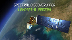
3.2 Spectral Discovery for Landsat-8 Imagery
Low-cost perpetual licence of Spectral Discovery for Landsat-8 Imagery (Version 3.1) can be purchased via PayPal.
Full Version 3.1 - USD 89 |
|
||
| - Handy band combinations | |||
| - Adaptive image stretching | |||
| - Advanced and fast image pan-sharpening | |||
- Rapidly make 120 band combinations (including image stretching) in a batch mode. Now highlighting and selecting important image Features of Interest (FOI) becomes easy. 120 = 6x5x4, using 6 multispectral bands - Bands 2, 3, 4, 5, 6, 7 (~20 GB disk space required for each scene) |
|||
- Rapidly make 336 band combinations (including image stretching) in a batch mode. Now highlighting and selecting important image Features of Interest (FOI) becomes easy. 336 = 8x7x6, using 8 multispectral bands - Bands 1, 2, 3, 4, 5, 6, 7, 9 (~60 GB disk space required for each scene) |
|||
| - Rapidly calculate NDVI, with three types of outputs in GeoTIFF | |||
| - Rapidly calculate NDWI, with three types of outputs in GeoTIFF | |||
| - Rapidly calculate 56 normalized difference image feature indices in the generic form of (A-B)/(A+B), with three types of outputs in GeoTIFF | |||
| - Rapidly calculate 56 band ratios in the generic form of A/B, with three types of outputs in GeoTIFF | |||
| - User-specified threshold to generate binary classification image in GeoTIFF | |||
| - Including future upgrades and technical support | |||
|
|||