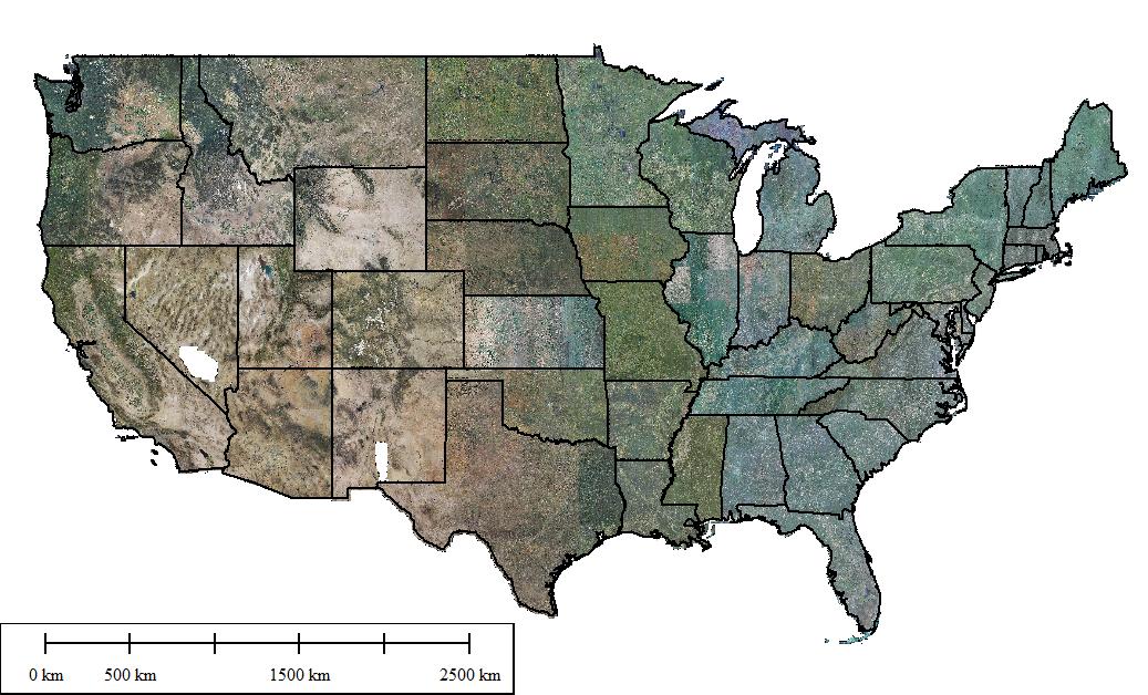
U.S. State-level Imagery Mosaics at 1m Resolution
- Based on Public NAIP Imagery Series (2013, 2014, 2015, 2016, 2017, 2018, etc. growing seasons)
- For 48 Contiguous U.S. States
Easy-to-use state-level imagery mosaics are made possible with the comprehensive ortho aerial photos available from the USDA National Agriculture Imagery Program (NAIP) and through wider collaborations in acquisition, storage and processing. Instead of using hundreds of thousands of the original NAIP imagery tiles, the uniquely-processed state-level mosaics are being offered at 1m-resolution for 48 contiguous U.S. States. This imagery product features:
- One state, one imagery mosaic – extremely easy to use and manage in GIS mapping software
- Consistent 1m-resolution with the popular WGS 84 Web Mercator projection
- See the big picture and the detail
- Complete public NAIP imagery series from recent seasons
- Large sizes: e.g. for the 2013-2015 imagery series, ~180 Terabytes of processed data in raw binary and ~9.0 Terabytes in compressed JPEG2000 format
- Complementary to the existing small-sized county-level mosaics
- Natural color (RGB), color infrared (CIR), or NDVI color mosaics available
- ...
This is a uniquely-processed imagery product for potential clients (e.g. in basemaps production, precision agriculture, and terrain simulation) to save enormous time, resources and money; it can be readily and rapidly deployed in large-scale enterprise mapping projects.
| NAIP state-level imagery mosaics overview | Summary (e.g. 2013-2015 imagery) |
 |
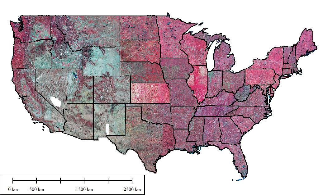
All statewide mosaics (natural color RGB) in the same projection (WGS 84 Web Mercator) ~90 Terabytes of processed data at 1m-resolution; ~4.0 Terabytes of compressed mosaics at 1m-resolution; ~230 Gigabytes of compressed mosaics at 5m-resolution. |
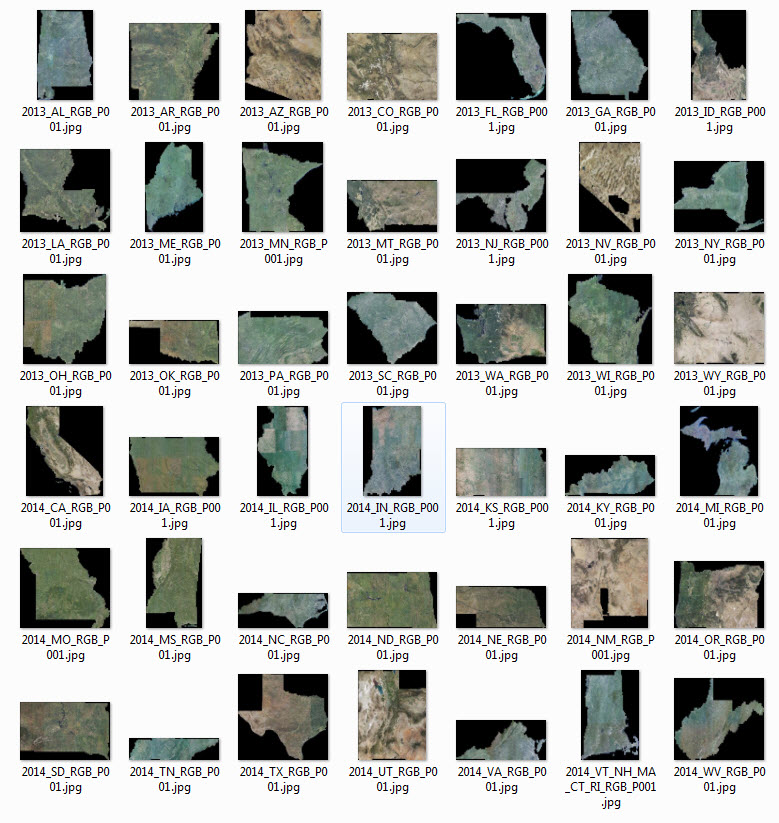 |
Natural color (RGB) mosaics by state (overviews were produced at 1km resolution; i.e. 1,000,000 - 1000, x 1,000 - times smaller than the 1m-resolution full mosaic) |
 |
All statewide mosaics (color infrared) in the same projection (WGS 84 Web Mercator) ~90 Terabytes of processed data at 1m-resolution; ~5.0 Terabytes of compressed mosaics at 1m-resolution; ~275 Gigabytes of compressed mosaics at 5m-resolution. |
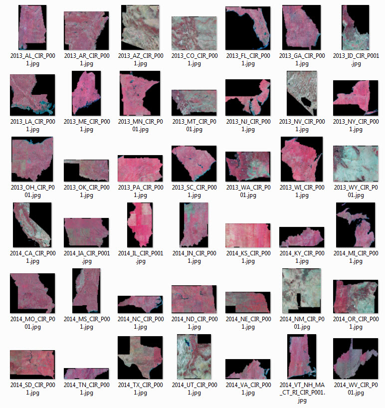 |
Color infrared (CIR) mosaics by state (overviews were produced at 1km resolution; i.e. 1,000,000 - 1,000 x 1,000 - times smaller than the 1m-resolution full mosaic) |
|
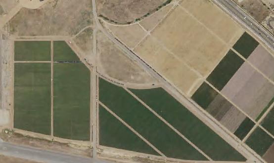
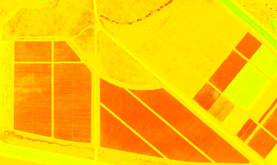
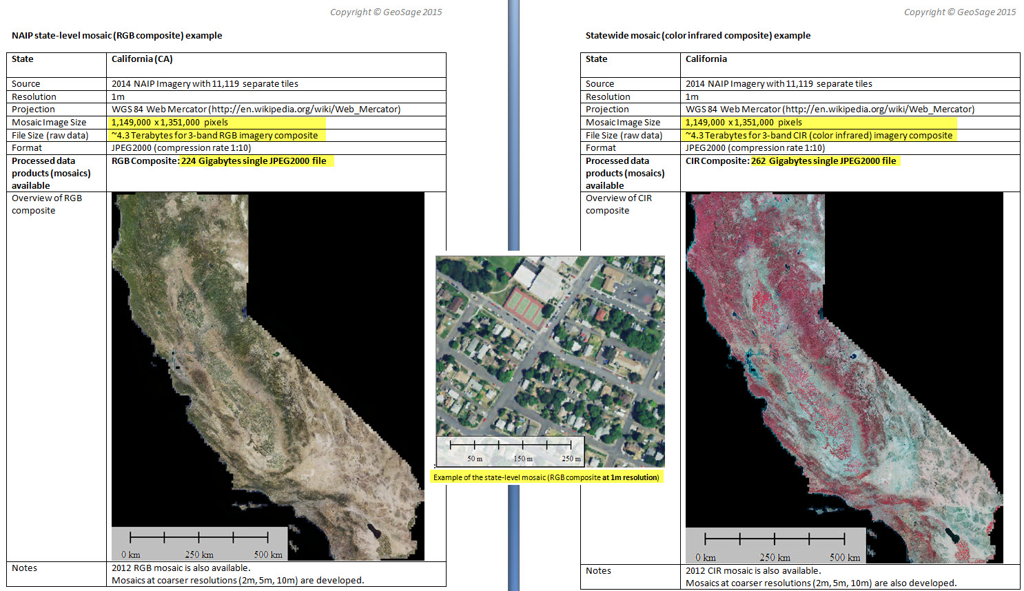
California: Example of the state-level imagery mosaics at 1m resolution |
Comparing RGB mosaic with NDVI mosaic