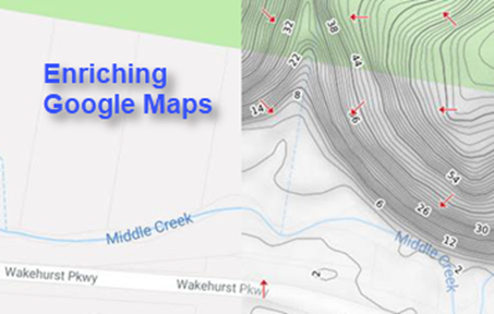
Mapping our land more clearly and colourfully
for better analysis and visualisation

02/2020: Cloud-based Geospatial Processing Services
- Turn Your High-quality Elevation Data into Feature Layers and High-resolution, Beautiful Tile Maps, ready for Web & Desktop GIS Mapping
 |
|---|
Many of us work with elevation data (e.g. LiDAR point clouds and Digital Elevation Models – DEMs) on a daily basis. Nowadays there are an increasing number of public sources for open elevation data, including high-quality LiDAR-derived DEMs.
Elevation data is foundational in geospatial mapping but it is often associated with large data sizes being hard to communicate underlying values or patterns to end users in effective and quantitative ways. Elevation data can be significantly explored and analysed for a wide range of innovative environmental applications.
We have recently developed a suite of cloud-based processing technologies and workflows that can quickly turn your usual DEMs into modern tile maps (on terrain and hydrology), which can then be readily consumed by web and desktop GIS mapping.
Three key differentiators:
1 - Traditional manipulation of DEMs is often based on desktop GIS software, but here we are focused on the rapid production of tile maps with cloud-based, scalable geospatial processing.
2 - Medium-resolution DEMs and derived information layers are in commonplace, but we are more focused on higher-resolution DEMs (e.g. at 10m, 5m or 1m resolution) and use these to derive insightful, measured contextual layers, involving analytical methods and processes that can be very challenging to many.
3 - Neat, self-contained outputs are very easy to use and can be shared widely (e.g. via website URLs).
Processing Services on Offer
We offer unique and efficient processing services. The only input from you is the elevation data that will be transformed into versatile tile maps.
| Inputs (from you) | Digital Elevation Models, LiDAR point clouds, etc. of any file sizes |
| Our processing | High-resolution tile maps on terrain and hydrology can include:
|
| Outputs (for you) | Produced map tiles can be delivered or accessed via a number of methods for web & desktop GIS mapping:
Tile maps can be used by usual desktop GIS software and easily integrated with web or mobile mapping apps (those using Google Maps APIs, Leaflet APIs, OpenLayers APIs, Mapbox APIs, etc.), by updating a file folder path or a related URL. It is straightforward and if it is unclear we show you how. You'd be amazed by how much the usual DEM data can be transformed into and effectively visualised. |
| Delivery time | Days, weeks or months, up to the processing task involved |
| Cost | Specific to individual projects |
| Other web services also on offer | We are also able to process any geospatial data and prepare beautiful, scalable map tiles ready for your efficient web & desktop GIS mapping. We offer integrated cloud computing services with Web API, Web App and Web Mapping. |
In the following we showcase a few applications of modern tile maps and some related case studies for worldwide locations. If you wish to find out more information or live demos, please feel free to contact us.
1. Typical Applications
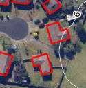
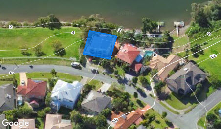
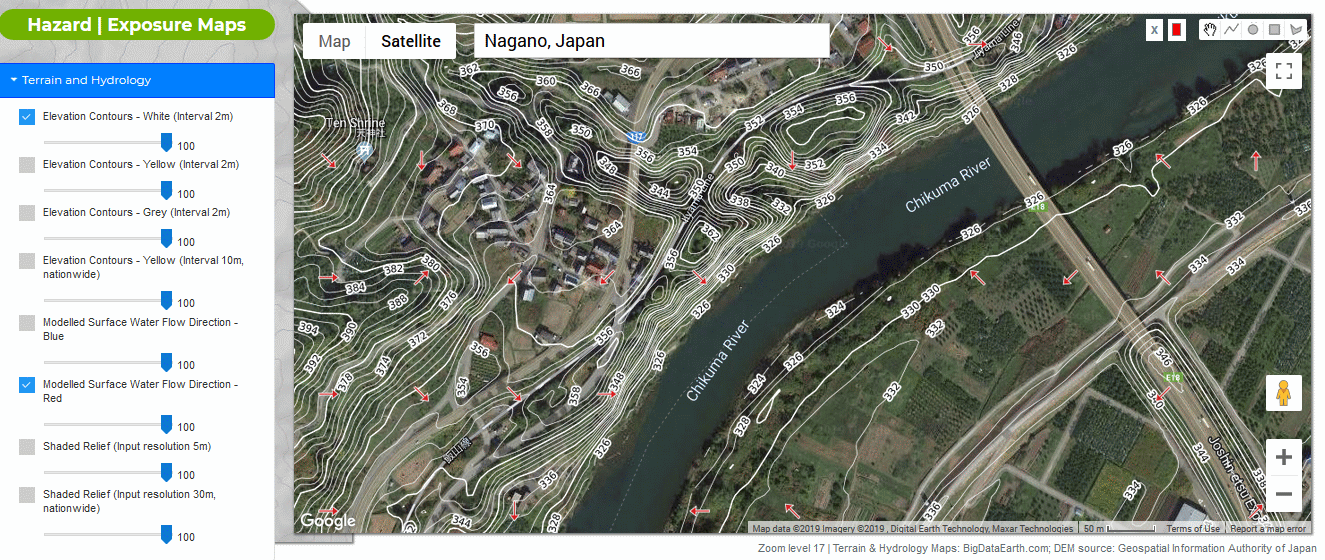
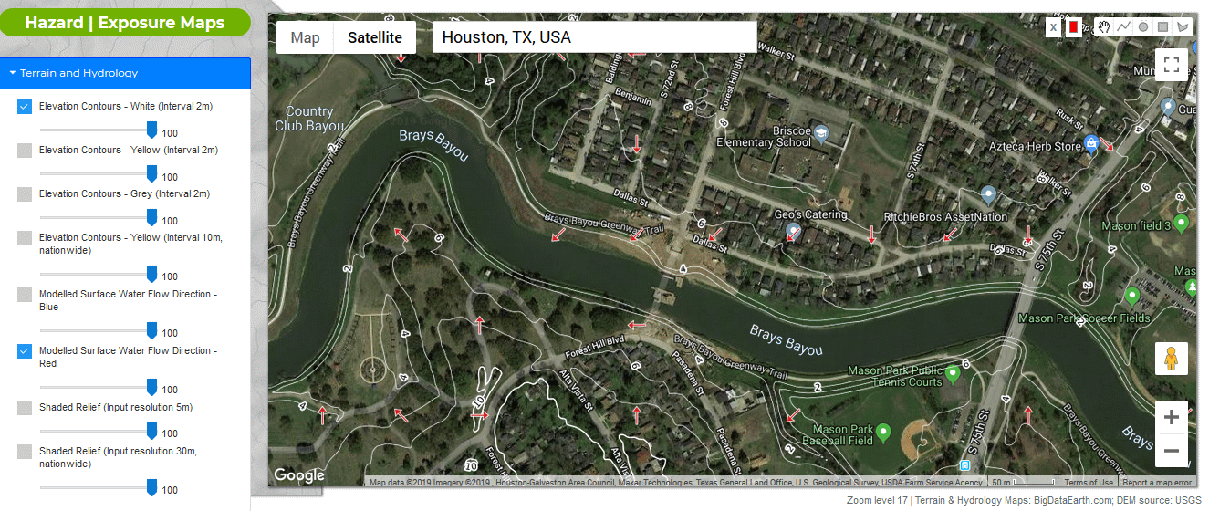
1.1 - High-resolution contours complementary to high-resolution imagery mapping |
|---|
 |
|
 |
|
 |
|
 |
2. Case Studies
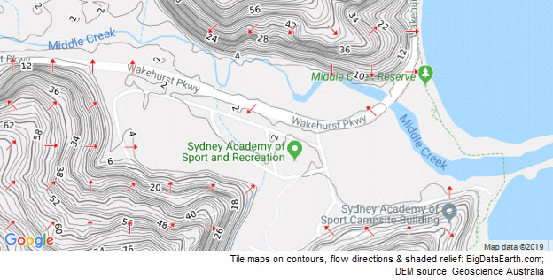
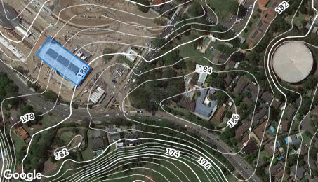
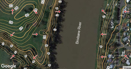
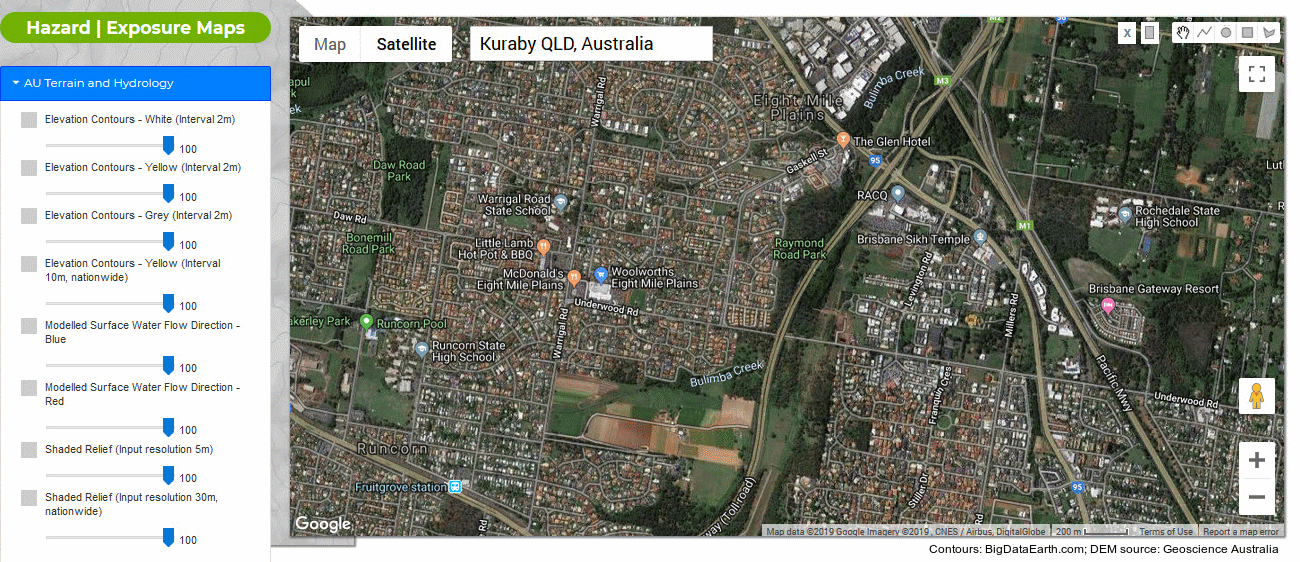
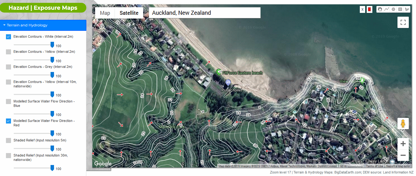
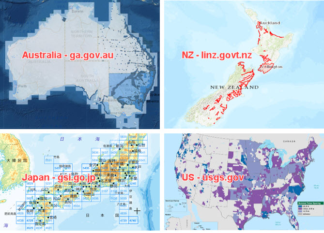
Nowadays public DEM data can be often obtained from government agencies.
The following figures show a few elevation data sources from Australia, New Zealand, Japan and the United States, and example tile web maps on terrain and hydrology.
|
|---|
|
 |
|
 |
|
 |
|
 |
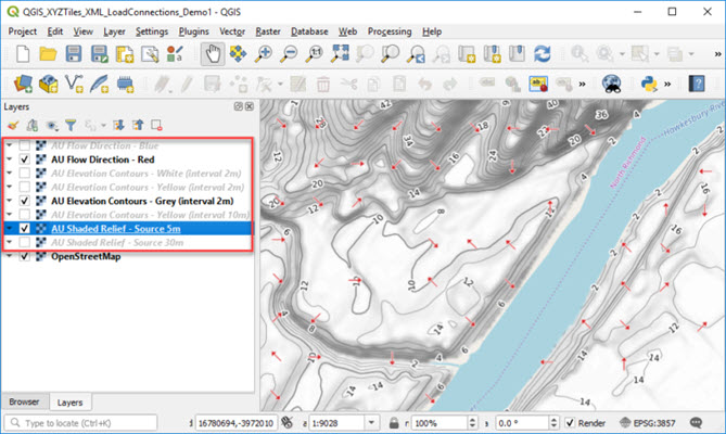
2.5 - Tile Maps for Desktop GIS Mapping |
The above examples show the application of tile maps for web / online mapping, which is increasingly popular and efficient. The same set of tile maps can be actually used for desktop mapping, and it is straightforward, too. For example, in QGIS, a user just needs to pass on a file folder path or a URL to “New Connection” after clicking “XYZ Tiles” button; a new tile map will be accessible serving as an additional GIS layer, as illustrated in the figure below. |
 |
Please stay in touch if you are interested in more examples and information.